Why This Site Exists
We built this guide because we kept showing up at trailheads unprepared. Trail descriptions that call a four-hour rock scramble "moderate." Sites that rave about a lookout without mentioning the parking lot fills by 9 am on summer weekends. Tourism pages recommending Scenic Caves without noting it costs $30+ per person.
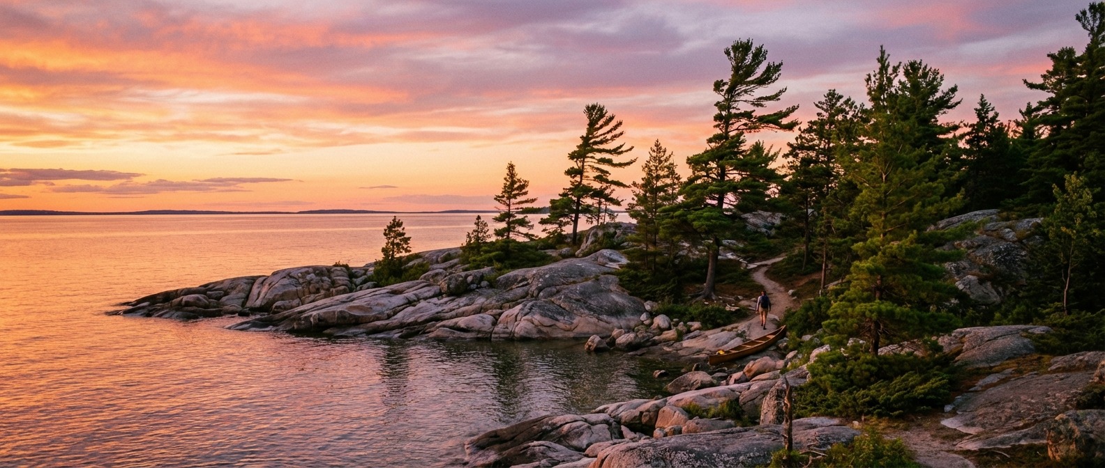
Georgian Bay has some of the best hiking in Ontario. The Crack at Killarney is a genuine bucket-list trail — but it is Killarney's most difficult hike, takes experienced hikers 4-6 hours, and often requires all four limbs on the scramble sections. The Nottawasaga Bluffs caves are unlike anything else in southern Ontario — but the Keyhole requires you to physically remove your backpack, push it through the opening, and squeeze yourself through after it. The Kolapore Uplands in fall are worth driving hours for — but some sections are poorly marked and you need an offline map.
The gap between what tourism websites say about these places and what you actually experience on the ground was wide enough to ruin a trip. So we started documenting what we actually found.
What We Actually Document
Every trail on this site includes the details that matter on the ground:
- Real distances — GPS-measured, not rounded to a nice number
- Actual elevation — including the cumulative ups and downs, not just start-to-finish
- Honest difficulty — terrain quality matters more than distance for most hikers. A 2 km granite scramble is harder than a 10 km rail trail.
- Parking reality — lot sizes, when they fill, and what to do when they are full
- Cell coverage — no coverage at Killarney backcountry, patchy at Killbear, fine in Collingwood
- Costs — Ontario Parks daily vehicle permits ($14-21), Scenic Caves admission ($30+), conservation area fees ($5-10 or free)
- Seasonal conditions — mud season timing (late March to late April), bug levels (June is brutal, tolerable by August), ice on north-facing slopes into May
- Footwear notes — which trails actually require hiking boots versus which are fine in sneakers
Five Regions, Honestly Described
Georgian Bay North Shore
Killarney and the French River corridor. The hard hiking. The Crack is Killarney's most difficult trail, marked with red signs (if you see only blue, turn back — that is the 78 km La Cloche Silhouette). Granite Ridge is just 2 km but the scrambling makes it feel like 10. Backcountry campsites sell out months in advance for July and August. No cell coverage in the park. Daily vehicle permit required: $18. Full North Shore guide.
South Georgian Bay
The Niagara Escarpment. Nottawasaga Bluffs is free with a small parking lot off the Sideroad — arrive early on fall weekends. Scenic Caves is a commercial operation with admission fees, but the suspension bridge and cave network are genuinely unique. Pretty River Valley has old-growth hemlock that few people see because the descent into the valley is steep. Kolapore Uplands has 60 km of trails and is the best-kept secret in the region. Fall colour peaks last week of September through first week of October. Full South Georgian Bay guide.
Parry Sound Area
Killbear's Lookout Point Trail (3.5 km, 1.5-2 hours) is the classic Georgian Bay hike: Group of Seven scenery. Not all Killbear trailheads have parking — the Day Use lot at Twin Points is the largest. The Massasauga is mostly water-access only from Pete's Place off Healy Lake Road (exit 189 from Highway 400). Massasauga rattlesnake habitat — stay on trails. Huckleberry Rock lookout east of town has blueberries on the summit in late July. Full Parry Sound guide.
Wasaga & Collingwood
The accessible entry point. Most Wasaga Beach visitors never discover the dune trails behind the beach — genuine parabolic dune formations with rare plant species. Cranberry Marsh boardwalk is wheelchair-accessible and genuinely excellent for birding. Spirit Catcher trail in Collingwood is paved, flat, and the best sunset walk on the south shore. Summer weekend traffic is heavy — visit on weekdays. Full Wasaga & Collingwood guide.
Inland Trails
The overlooked network. Copeland Forest near Craighurst has 12 km of paths and genuine solitude. Tay Shore Trail is 22 km of flat crushed-limestone rail trail along Severn Sound. County forests throughout Simcoe and Grey are free, have parking, and see almost nobody. The Ganaraska Trail Wasaga section through the sand hills is unexpectedly good autumn colour. Full Inland Trails guide.
Getting Started
New to Georgian Bay hiking: start with the Beginner's Guide for gear and safety basics. See the Best 15 Hikes for our ranked picks across all levels. Check Trail Planning for permits, parking, and cell coverage. Or jump to a region or trail type.
What We Document
- Real distances and elevation
- Honest difficulty ratings
- Parking lot fill times
- Cell coverage maps
- Permit costs
- Seasonal mud and bugs
- Footwear recommendations